The Hebridean Way can be walked or cycled, traversing the Outer Hebrides from Vatersay to Stornoway or the Butt of Lewis, respectively. Since substantial roads are relatively few, simply moving around the archipelago means covering large portions of its route. In late July and early August 2018, we took the Oban-Barra ferry and travelled north to Stornoway for the return boat to Ullapool, partially following the cycle route with detours and omissions. Having explored the Uists and Berneray during Christmas 2017, we covered these islands relatively quickly, pausing for longer in Harris and Lewis.
Oban to Vatersay
 Oban Harbour
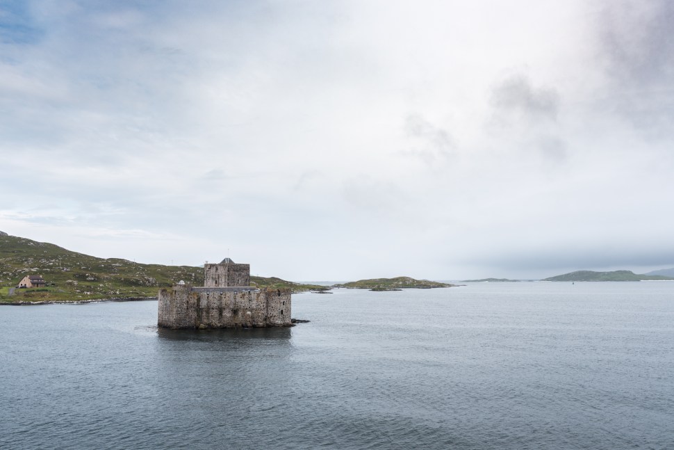 The castle after which Castlebay, Barra, was named
 Sound of Vatersay (Caolas Bhatarsaigh) and causeway


 Tràigh Siar bay at sunrise
Barra to Eriskay
 View toward South Uist from Ardmhor ferry terminal
 Fuday Island on the horizon from the Barra-Eriskay ferry
 Bagh Shaltabhaig and Ludag, South Uist, from the Eriskay causeway road
The Uists
 Approaching storm front over the Beinn Mhòr range, South Uist
Balranald, North Uist


 After the storm, beaches and machair-covered headland forming the Balranald RSPB reserve. This mixture of croft land, machair (low-lying, fertile grassy plain found only on the west coast of Scotland and Ireland), beaches and rocky headlands hosts threatened and declining species including the corncrake, corn bunting, lapwing and the rare great yellow and moss carder bumblebees. We found both the latter busily feeding on blooms all over the reserve as if we’d imagined the 24-hour turbulent deluge that had just ended. The RSPB owns none of the reserve’s land; rather, it’s composed of 40 working crofts under three landowners in four townships under an agreement formed in 1966.
 View east from the Balranald campsite shortly after a female hen harrier had caused panic among the resting lapwings as she quartered the grassland around the cemetery.
 Pit stop at the Co-op, Sollas
Harris and Lewis
 Leverburgh harbour
Horgabost and Seilebost
 Tràigh an Taoibh Thuath beach and Ceapabhal hill from the coast road.

 The Harris hills from Horgabost beach
 Tractor rally on Horgabost beach

 Seilebost beach
Glen Ceann an Ora and Glen Vigidale

 Glen Ceann an Ora climbs fairly steeply from sea level, funnelling high winds in an unpredictable way that made a fully laden touring bike difficult to handle safely, and pushing the most sensible means of proceeding.
 The track rises up Glen Vigidale from Borgha Glas, next to Loch Seaforth, into the North Harris hills


 Rain over Loch Langavat

 There is a weekly ‘eagle walk’ up the glen on Wednesdays from Bogha Glas car park. The area features on the Outer Hebrides Bird of Prey Trail — the north Harris hills have the highest European golden eagle breeding density. Although our own participation in the walk was on one of the rare occasions that an eagle was not sighted, an individual sailed low over our heads a few hours later on the mull of Pairc.
Pairc (Park, South Lochs)
Almost an island and composed largely of water and boggy peatlands, Lewis’ Pairc peninsula is remote even for Britain’s northwestern extremity. Its de facto cultural centre is the Ravenspoint visitor centre in Kershader (another point on the Bird of Prey trail, with local white-tailed and golden eagles), with a heritage and wildlife museum, local records library, store for basic provisions, café and hostel.
Our exploration of the largely uninhabited southern region, with its deserted townships and mosaic of salt- and freshwater lochs, was curtailed by unrelenting horizontal rain driving off the mist-cloaked Atlantic beyond and will have to wait for another time.
 View across Loch Erisort from the garden of the Loch Erisort Inn, which allows free camping and use of facilities when the inn is fully open to the public in the evenings.
 Stone circle near Sheildinish
 Habost post box
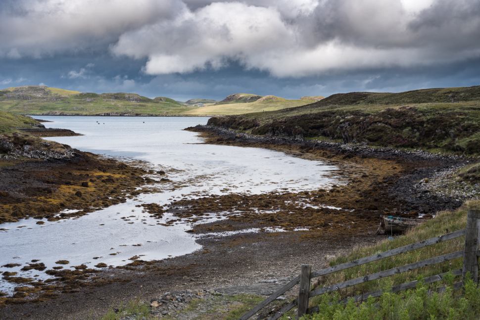 View over Loch Erisort


 Pairc’s southern hills
Ullapool


 The Stornoway ferry operates to and from Ullapool on Loch Broom. The original hamlet was converted to a herring port in 1788. Numerous attempts at fundraising for construction of a railway to serve the town have been unsuccessful, probably due to the prohibitive cost of the implied engineering solutions to the challenges posed by the region’s geomorphology. A bike bus service is available to transfer cyclists and their kit to the nearest mainline station in Inverness.