These four mixed surface cycle routes vary from a little to almost all unpaved surfaces. They’re not particularly gnarly, and certainly not technical, and could be completed on a hybrid or road bike with suitable higher-volume tyres. Cyclocross, adventure, all-road and gravel type bikes would probably offer the best balance between comfort and speed. Originally posted during the Covid-19 lockdown of spring 2020, the third route (Aylsham and Blickling) was added in December of that year.
As circular routes, they can be accessed from any point on the loop and may be completed in either direction. I started and finished in Melton Constable, where I lived. The on-road paved sections are almost all quiet lanes, with brief crossings of main roads where necessary. Each loop represents a day ride in its own right but they also potentially function as extensions to the Norfolk long distance Forest to Sea (F2C) routes.
There are a multitude of opportunities to buy refreshments and provisions en route, some of which are highlighted on the GPS tracks below.
Melton Constable and Wells-next-the-Sea (44km; 12% unpaved)
A mainly on-road route through some of North Norfolk’s finest countryside and a selection of its most picturesque villages, with three miles (5km) of gravel linking Wells and Wighton. This can be easily avoided by using Warham Road and creating a 100% tarmac ride, if desired. It takes in two Norman abbeys and numerous churches, and I’m never without binoculars due to the wealth of birdlife usually encountered. Look out for barn owls, marsh harriers and red kites in particular. In winter, they’re joined by other birds of prey and many thousands of wildfowl.

From Melton Constable it’s a net descent to the coast via Binham, where you’ll encounter the first of the two Norman priories. In Wells, you’re spoilt for choice for food and drink. You can enjoy a take-away on the quay or head to the beach through the pinewoods.


Leaving Wells along Market Street, past the high school, you’ll take a wide greenway south to join the gravel track linking Holkham and Wighton. You can divert slightly into the village to admire the church and visit the pub.


More amenities are available in Little Walsingham, where the Farms Shop is worth a stop if you’re hungry, or towing a trailer as we sometimes do on pedal powered shopping trips. It’s also home to the second Medieval abbey.

After crossing the ford at Great Walsingham you’ll wind your way to Melton Constable via back lanes and quiet villages.
Melton Constable and Aylsham (49km; 29% unpaved)
This route begins on higher ground in Melton Constable and descends to Foulsham (it’s surprising how much temperatures can drop over this short distance, with frosts relatively rare in Melton but much commoner down the ‘hill’ in Hindolveston). It follows the northern section of the ‘Themelthorpe loop’, part of Marriott’s Way, to reach Reepham and Aylsham, returning via small lanes through the Heydon area to Briston.


You’ll leave Aylsham via the Heydon Road toward Oulton, crossing the Norwich-Holt road and taking a track through Park Farm. The adjacent gravel road through the Heydon estate to the village is marked as private and signs at the gate near Heydon church state that walkers are welcomed but don’t mention cycling. If you have any more definitive information on cycling on estate paths I’d be grateful if you’d comment below.


When the Heydon Village Tea Room is open it’s well worth a detour. Otherwise, you’ll skirt the estate walls and continue along quiet lanes to meet the Reepham Road south of Briston.

Melton Constable, Blickling Park, Edgefield and Hunworth (51km, 32% unpaved)
Also beginning in Melton Constable, this route is similar to the previous one as far as Aylsham (but reaches the Marriott’s Way in Themelthorpe via Guestwick rather than Foulsham, although both work equally well), where you loop north through Blickling Park in the estate of the Hall. You’ll then follow lanes to Edgefield and Hunworth, both with pub/restaurants, returning uphill to Melton past the ruined tower of St. Mary’s church and its replacement 19th Century tin tabernacle.


Marriott’s Way and Bure Valley via Coltishall (62km; 82% unpaved)
I get to this route from Melton Constable, riding to Themelthorpe via the country lanes in the loop above. It’s also handy for Norwich and the Broads, and, with a national rail station at Hoveton and Wroxham, you can reach it from almost anywhere. If you’re in West Norfolk, take a look at the F2C long-distance route from the Peddars Way through Aylsham to Great Yarmouth.


It includes most of the Marriott’s Way, omitting only the section between Norwich and Thorpe Marriott (of course, Norwich is a possible diversion, adding 12 miles’ round trip), and the entire Bure Valley Railway cycle path linking Aylsham and Hoveton (for Wroxham). The latter is narrow and best enjoyed at quieter times. Early morning is ideal, with misty sunrises as a reward.


A paved interlude of around seven miles (11km) in length links the gravel and woodland sections that form the vast majority of this route. Take care on the short section (about 400m) along the A140 Norwich-Cromer road between the village of Newton St. Faith and Green Lane, the main access through Horsford Woods.

The route takes one of the many paths upon which cycling is permitted through Felthorpe Common. Do please show the usual courtesy to other users of the area.

If travelling clockwise (south-west in this case), you’ll exit the Common to meet Norfolk County Council’s ecocidal abomination, the Norwich Distributor Road. Take care in using one of its pathetic cycle ‘crossings’ to join the paved cycleway parallel to the hideous traffic sewer, rejoining the Marriott’s Way at the footbridge and heading toward Lenwade and Reepham.

Thanks so much for posting these!
We’ve done the first two rides and loved them – a great ride for gravel bikes whilst taking in some Norfolk nature and scenery.
On the 2nd ride, the tea shop is in Heydon – we found it by accident as thought it was Oulton from the description. It has to be one of the best tea shop stops we’ve ever made!
You might want to add ‘Heydon’ into the description as it’s easily missed otherwise. especially as there is never any phone signal in Norfolk!
Thanks, glad you enjoyed the rides. The Heydon Village tea Room is labelled (in Heydon) on the Ride With GPS map I’ve provided.
Best,
Chris
Chris
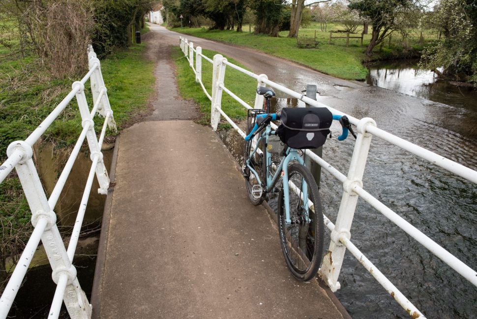
Great looking rides. I know the roads in the areasreally well having holidayed in Corpusty for years. I’m just in the process of buying a gravel bike so will look forward to riding all these routes next summerand getting a whole new Norfolk expereince. Lovely pics too. Keep them coming. By the way, what’s the bar bag you’re using?
Hi Michael, thanks very much for your kind comments. The bar bag is the Ortlieb Ultimate 6 Classic (7L I think, also available in 5L). Enjoy the rides!
Having discovered this very useful article and gravel rides we have brought our Basecamp to Old Brick Kiln caravan park so we can ride a couple of these routes. Completed the trip to Wells today and really enjoyed it. More good weather forecast tomorrow and another planned.
That’s great David, thanks for commenting. Fantastic gravel riding weather for you – have a brilliant day!
Hi Chris, thanks so much for these routes. Jane and I just starting with gravel bikes after 10 yrs on road bikes. We did little bits of the King Alfred’s Way as a trial this summer but found that 30 miles a day was enough (until we found tea and cake to sustain us further). Your routes and distances look just grand for us. We live near Gt Yarmouth but love the Aylsham / North Norfolk areas so look forward to trying a few of your circuits this autumn perhaps.
Hi Fergus, my pleasure. If you check out my ‘F2C’ and Norwich to Yarmouth routes elsewhere on the blog you’ll find routing via bit of gravel and bridleway around Caister Castle. It’s then paved until Stalham, where you can pick up the Weaver’s Way to Aylsham, then Bure Valley path to Wroxham or Marriott’s Way to Reepham and Norwich. More than your 30 mile preferred distance but if you made an overnight B&B stop you’d have a nice couple of days’comfortable cycling and could use the train to get back to Yarmouth if you liked.
Good also that you have gone to the trouble to make these circular routes joining various different “straight line” named trails together. Aren’t we lucky to have these old Beeching railway lines to form the backbone of off road cycling in Norfolk. Never too steep! Certainly the nice photos and description give inspiration to folks like us to explore further – keep up the good work on your site – it deserves to be well recognised.
Hi, I’m a keen cyclist, from Cambridge. We regularly cycle/ bike pack up to Norfolk & around Norfolk. Have just discovered your fantastic blog ! I’m always trying to find a good route NE from us to NE Norfolk via the Brecks/ Thetford Forest. We use small roads & tracks. There seems to be a wide area around Brandon where there are no tracks or roads, military area where you can’t make a route. Wondered if you have cycled this?
We always end up cycling N via Downham Market because of this problem.
Hey Julie, thanks for your kind comments, glad you like the blog. Unfortunately that’s the part of Norfolk I know the least – I’ve only ever headed north out of Thetford on the Peddars Way, or entered the Brecks on-road via Swaffham. I can see some forest routes south of Brandon on Komoot, but obviously the Thetford Rifle Range, RAF Lakenheath and Barnham Camp/RAF Honington are displayed as out of bounds.
Sorry I can’t be of more help with direct experience this time.