Route and logistics
I followed the first (northern) section of the Traversée du Massif Vosgien (TMV), or Vosges Mountains Traverse, between Wissembourg and Saverne in the Bas-Rhin department of Alsace. Adding in a ride from Haguenau to Wissembourg (this last section of the Strasbourg-Wissembourg branch line is currently closed for works) I covered 108 miles and around 10,000 feet (3,000m) of climbing.
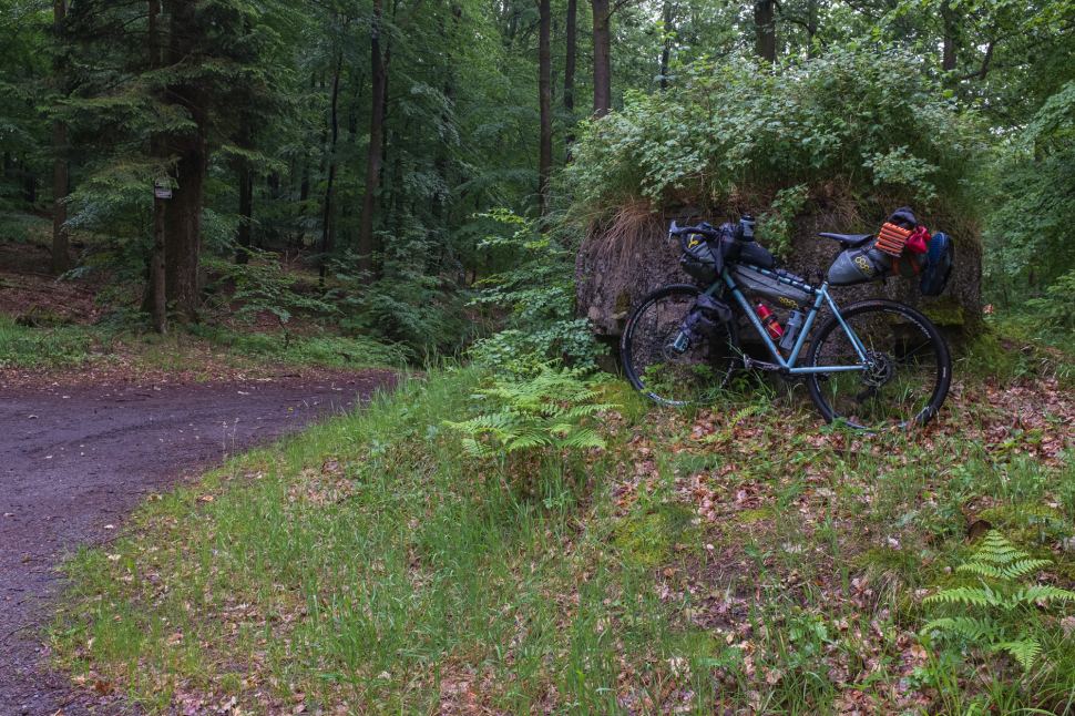
Although designated as “à VTT” (vèlo tout terrain, or mountain bike) the TMV is highly rideable on mostly well-surfaced forest doubletrack and wide singletrack. There is some tarmac and narrower, rougher singletrack, but, save a series of dirt descents in the Zinsel valley, little that I encountered (unless by error) in the northern section could be described as technical.

However, and this is a big however, route finding is challenging. The TMV markers are not quite comprehensive and cannot be relied upon. Those that do exist are very easy to miss, or are sometimes ambiguous. In sections near La Petite Pierre, two sets of contradicting markers exist, something I’ve yet to discover an explanation for. The paper maps I was able to obtain were of limited use in navigating the dense network of identical-looking forest trails, and GPS is often inaccurate in tree cover (see below for unfortunate anecdote).
I downloaded the GPX tracks from the Cycling Alsace site and followed them passively (active navigation ate far too much battery). I also had paper copies of the French language route guide (now out of print but available digitally on the cycling site). These offer only higher-level navigation tips and major waypoints. Ideally, a dynamo hub or sufficient spare battery power would enable your electronic navigational aid of choice to be in constant use in order to identify missteps quickly.
I wouldn’t recommend less than around 40c tyres, run at lowish pressures to deal with sandy and muddy sections. 2 inch+ rubber would make things faster and more comfortable, as would a front fork, but a fixed rig with fattish tyres is perfectly adequate, even with camping kit. On the tech note, a big shout out to Simon and Gavin at Pedal Revolution Norwich, who went out of their way to set up and troubleshoot my tubeless setup in time for this trip — it worked flawlessly, thanks guys.

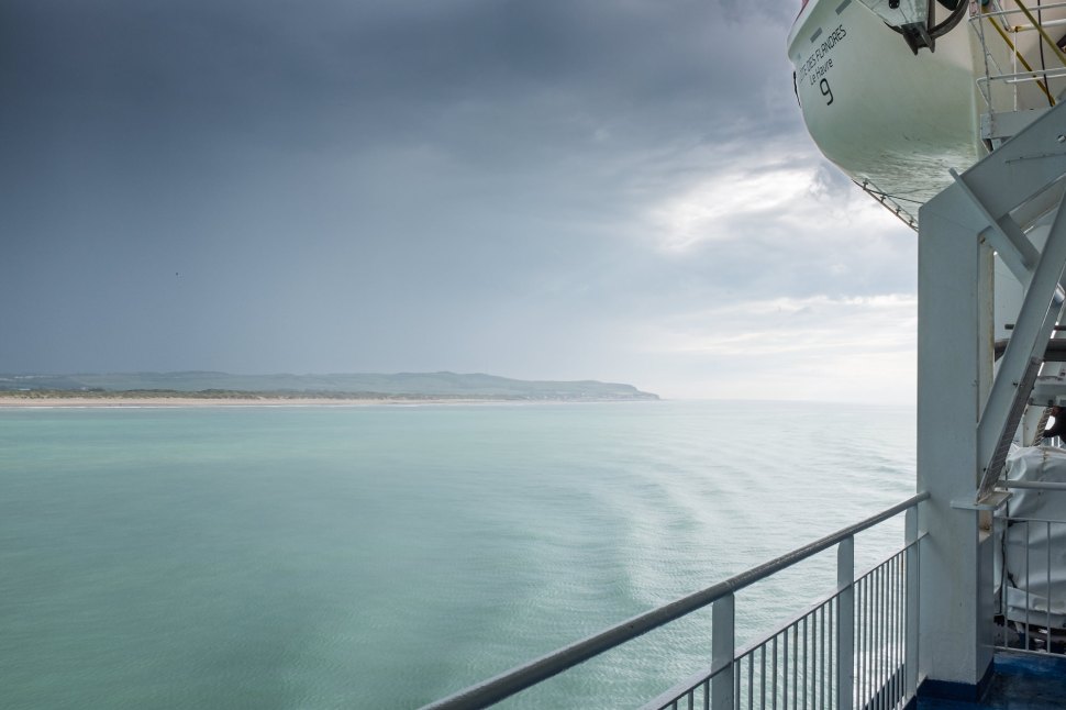
UK logistics were pretty straightforward — an inter-city train from Norwich to London Stratford (cycle booking required) and connection via HS1 high speed service to Dover Priory, which was reasonably priced when bought a little in advance. The Dover service accepts cycles on a first come, first served basis. I booked on an evening DFDS sailing to Calais while on the Dover train, working out to be only a few pounds more expensive than doing so the day before.
Unusually for the UK, the cycle journey from Dover town centre through the port is pretty smooth and stress-free. A fairly decent dedicated, off-road bike path links town and port, and a clearly marked red line system shows riders where to go upon arrival. The slightly embarrassed customs staff made a token check. We agreed that my possession of a penknife was acceptable because it’s not a flick knife and I was on my way.
Where the red line system breaks down somewhat is in terminating before the ferry boarding lanes, leaving cyclists to mingle with articulated lorries in travelling to the assigned waiting area.

In Calais, there is a foot and cycle bridge to town from the passenger terminal, but bikes must behave like motor vehicles and it’s not signposted from the disembarkation point, because pedestrians don’t go there. From reading of other cyclists’ experiences, I was anxious not to unintentionally end up on an autoroute by following the only exit signs provided. I arrived in a downpour and the port staff helpfully signalled for me to follow their van across the mostly empty lanes to an access gate that opened onto the cycle path to town.
The return journey, also made in a thunderstorm, required queuing for passport control, check-in and boarding with multi-tonne cars, vans and trucks, breathing toxic fumes and relying upon their operators’ common sense to avoid riders (something they don’t always demonstrate on public roads). Again, a 10kg (OK, 25kg in the case of my loaded rig) cycle can be readily pushed and lifted, and it seems perverse that at least check in, security and immigration formalities can’t be made on foot, as in the case of Italy and Greece.
Arrival and departure
The €9.50 for DFDS’ vegetarian lasagne seemed less extortionate when the salad, garlic bread and purée de petits pois were thrown in, and less good value once again when it predictably transpired to consist of bland, insipid nastiness. In my true fatalist, catastrophic spirit, I had prepared for a number of arrival scenarios that wouldn’t happen, including “what if the train is rammed or the bike is refused and I have to cycle to Boulogne?” Hence, I thought it wise to fuel up on the boat.
Unfortunately, the Strasbourg line is one the TGV routes that doesn’t accept whole bicycles. And, because part of a bicycle would be less useful to me in my woodland travels, it was going to be a regional train relay marathon the like of which I’d not undertaken since travelling from Umbria to the outskirts of Turin for the trans-Alpine Nice tour.
It’s not possible to do the whole journey to Wissembourg in one day and I’d booked a small apartment in the — rather charming as it happened — old quarter of Boulogne-sur-Mer. My delight, albeit tinged with slight disappointment at being wrong, that there was nothing remotely disastrous about the train ride from Calais was heightened further by black redstarts singing from the rooftops and a peregrine powering in to alight on the cathedral dome.


The outward train journey was Boulogne Ville > Paris Nord; Paris Est > Châlons en Champagne > Metz > Strasbourg > Haguenau, with an overnight in Strasbourg before making the final leg. Then, a 22 mile ride to Wissembourg, since the bike isn’t carried by the rail replacement bus service (makes one feel at home) currently operating on the last section of the line.
The return also involved an overnighter in Boulogne’s ex-convent and was as follows: Saverne > Nancy > Bar-le-Duc > Paris Est; Paris Nord > Boulogne Ville; Boulogne Tintelleries > Calais Ville.


Strasbourg to Wissembourg
The TER regional network is generally fine for bike carriage. The best kind, I feel, have a large section of hanging hooks. Although clean jerking 25kg of irregularly shaped steel and luggage is an initial pain, it holds them securely and undamaged, keeps aisles clear and obviates the need to establish where fellow riders are getting off, which is a feature of stacking systems.
When the train becomes a bus, however (even a still very bussy ‘rail bus’), cyclists must proceed under their own steam. The rural cycleway network, while not ubiquitous, is the stuff of dreams for UK pedal fans, who are generally accustomed to provision that constitutes slippery white paint and glass-covered pavements, usually with instructions to “dismount”.

The network around Haguenau takes cyclists off the busiest, fastest roads and links a number of villages with bike-only forest and cross-country routes. I’d still argue that the “cyclists beware” warnings at road crossings would be better directed at those operating speeding two-tonne boxes, but it’s another world from Britain’s largely worse than useless, and often life threatening, infrastructure.
I don’t subscribe to the notion that continental European drivists are inherently any ‘better’ than their UK peers — indeed, where the infrastructure stops and motors mix with bikes, it’s my perception that French and Italian pilots of mobile living rooms are often worse at safe overtaking, for example. However, because European bike networks tend to be of high quality, they are used, reducing the scope for conflict among user groups and, ironically, allowing motorists to proceed with more limited interaction with their two-wheeled nemesis.

The undulating topography of this part of Alsace means that one is generally either climbing or descending, but rarely for long or at an extreme rate. Regrettably, most villages route motor traffic directly through their centres — contrasting with the Italian Zona Traffico Limitato model — greatly reducing enjoyment of them and the urge to hang around for long.


The main trail
Wissembourg, a Gallicization of Weißenburg or “White Castle”, grew around a 7th century abbey. It is the northern trailhead for the TMV, which begins at the Maison du Sel, taking its name from historical use as a salt warehouse, and follows local cycle paths along the Lauter river.


With busy Saturday morning traffic choking the centre in all senses, and narrow pavements dominated by parked cars, I was anxious to finish my breakfast and get on the trail. I would later regret the decision not to pause for food shopping — even in mid-June, I overestimated the availability of provisions in the smaller villages I’d be passing through.

Local paved routes quickly become the TMV proper, climbing gently into dense forest and leaving the motorised world behind. The trail here is well-marked, broad and obvious.

The route dips in and out of forest blocks. Climbach had a small bakery, where I scored a tarte flambée or flammekueche (rural France doesn’t really do vegan and not eating isn’t an option for the energetic bikepacker) and a suitably sugary Coke. As I was finishing this pleasingly large, hot fat-fest, it began to rain, a light patter that gave little warning of the deluge to follow later in the afternoon.

Soon after Climbach, the route took one of its occasional inexplicably complicated and difficult detours. In this case, it dove off the pavement into a steepish woodland descent, interrupted regularly by large felled trees, before rejoining the tarmac via vaulting an electric fence, thankfully just short of inside leg length. On other occasions, it leaves smooth doubletrack to climb or descend brief but brutal stretches of technical singletrack, which, for me, meant hike-a-bike. Had I not been reliant upon my Garmin’s very limited capabilities as an active navigation tool, I’d have freestyled these sections and simply continued without diversion. However, it was hard enough to keep on-track, let alone evaluate alternates, using the 810’s legendarily unhelpful interface.


The Steinbach Valley, part of the Parc Naturel Régional des Vosges du Nord, is dotted with ancient castles and criss-crossed by mountain bike routes. This is an added attraction for those following the TMV on such a machine. Following a red-rated mountain bike route on a fully laden gravel/adventure type rig in pouring rain by mistake was less of a highlight, but it did lead to an interesting unplanned visit to the ruined Château de Frœnsbourg, with its troglodyte cave rooms.


By this point, the navigational challenges had become manifestly clear and missing a roadside marker while the Garmin was switched off to preserve battery life led to another detour, this time a two-minute stay in Germany’s Südwestpfalz district.


This part of Alsace’s border with Germany was one of the more heavily fortified sections of the Maginot defensive line, constructed in the 1930s with the objective of deterring or slowing an invasion from the east. It was rendered redundant by the flawed assumption that the more lightly fortified Belgian Ardennes Forest to the north was too impenetrable to be crossed sufficiently quickly by Hitler’s Panzer forces that defenders would not have time to react, engage and repel an attack. It was later used to some extent in the Germans’ similarly ineffective rearguard action as American tank troops advanced through the Saverne Gap and on to the liberation of Strasbourg in 1944, although the allies also sought to bypass the strongest defences.


Although the forest provided some cover from the increasingly intense downpour, the going was becoming tougher as mud and surface water slowed progress. As I approached the relatively large town of Niederbronn-les-Bains, a deteriorating hiking shelter provided a disproportionately attractive overnight camping option. These were otherwise limited, with steep drop-offs on either side of much of the trail. However, I’d been unsuccessful in picking up provisions en route and continued on to town for pizza. I elected to return back up a steep paved climb to the forest and its hut in preference to gambling on quickly finding a suitable camping site further ahead on the trail.

I awoke to better weather, but also to discomfort and saddle soreness. Although this seems fairly trivial, if the skin were to break, the trip could be in jeopardy, risking agonising sores. I packed the bike with the intention of treating the problem and continuing, but the ride into town made it clear that making significant progress on rough roads would be a painful process. Having located a food store and pharmacy, where I was offered solutions for both treatment and prevention of further damage, I climbed slowly back to the hut for a day of rest and medication.


Having to sit out a fine riding day after the moist first leg was vexing, but it did offer the opportunity to air damp kit and brought out a diverse community of insects.


I was woken up by a rainstorm that raged from the early hours of the following morning. Looking up at the sky through gaps in the roofing I struggled to understand how I was remaining dry. That certainly wouldn’t be the case when I restarted my journey. But, just as dawn was turning to sunrise, the rain stopped and the sky cleared. Game on.


Retracing my steps, travelling in little circles, correcting detours and stopping to puzzle over the route may have even doubled the time I was taking to move on. I don’t rush, stopping to take photographs and investigate wildlife, but what seemed to be needless, energy sapping delays were irritating. Frustration turned to exasperation upon leaving the village of Lichtenberg. The trail appeared to end abruptly at a farmstead, with no immediately obvious alternative.
The GPS seemed to show the trail continuing across the field, over two electric fences, and onward up a slope through rank vegetation into more forest. At this point I should have rebooted the device. But this wouldn’t have been the first time that the trail was interrupted ‘illegitimately’. Having managed to get the bike beyond both fences while remaining miraculously unscathed by high-voltage electricity, I stood in a patch of stinging nettles at the foot of a steep slope bordered by a high fence and realised that whichever way I was supposed to go, this wasn’t it.
By now, a noisy dog had alerted its owner to my presence. I was almost relieved at the prospect of being able to ask a human for directional assistance, but also anxious that I was about to become a momentary distraction from Brexit on UK evening news as an apoplectic Alsatian shepherd removed my head with both barrels of a shotgun. That catastrophe thing again.
The ensuing exchange was predictably heated — despite my polite, apologetic demeanour — and tediously repetitive. Due to its shape, it would have been impossible to make it back over the fence while carrying the bike and, somewhat bizarrely, the stout, ruddy-faced farmer’s wife who had emerged ended up momentarily holding my bike while berating me for my negligence and destructive tendencies as I searched for a part of the barrier that remained below bollock-level. If it ever occurred to her that she could turn off the current, she must have dismissed the notion in favour of some light schadenfreude. I tried, and failed, to summon sufficient French to express that this was not a deliberate act — I’d rather be bouncing along a nice leafy path toward my destination than enjoying nettle stings, bramble cuts, an earful of angry landholder, fear of imminent electrocution and being apparently lost while powerlifting my awkward bike over obstacles half my own height.

The actual route was hidden, being almost as overgrown as the farm boundaries and barely passable due to the largest, densest collection of felled trees yet. This urgently needs addressing, seriously — from the English translation of the official TMV website: “Experts, experienced riders, beginner and families will all find that this route offers a wide range of experiences, discoveries or simply pleasure”. Erm, yeah. I have no images to offer for this part of the ride walk since I was busy swearing, panting, pushing, heaving and dragging.
I managed to beg water refills from a villager’s home after establishing that all the pumps in Wimmenau, the next village, were ornamental only. By the time I’d reached La Petite-Pierre in temperatures pushing 30 degrees, I was ready to gulp down several bottles from the village fountain, possibly fatefully.

Whether it was the momentary lapse in my water filtration policy in La Petite Pierre, something I ate, or the unsanitary nature of ‘bush’ life I will never know, but I spent most of that night covering the forest floor with my stomach contents. The following day, after resolving to clear up after myself but being impressed with the discovery that nature had already done its work, I travelled down the Zinsel valley to Dossenheim in a shivery light-headed blur. Having spent most of the day sitting in what shade was available I slowly made the six mile ride to Saverne, where a real bed and train station awaited. Despite the sleep-starved, cramp punctuated haze, I did note several white storks above Dossenheim.

Although the original plan was to continue with the central and southern sections of the TMV, it seemed sensible to conclude the trip in Saverne. If the route-finding and continuity issues can be addressed, the trail represents a genuinely accessible dirt tour that doesn’t require a full mountain bike, and takes in some beautiful, tranquil tracts of forest.