This blog post is the first in a three-part series presenting the ‘Forest to Sea’ (F2C) trans-Norfolk long distance ‘bikepacking’ or cycle touring route. The route, which I pieced together by linking off-road trails with quiet country lanes (some of which form part of the Regional and National Cycle Networks) is a 137-mile journey from Thetford, on the southwest Norfolk-Suffolk border, to Great Yarmouth, on Britain’s most easterly coast. In Part 1, I present a photographic record of the Thetford to Cley leg. The whole route has a separate, dedicated page, with interactive mapping, video and a comprehensive, highly detailed guide available for download for a small fee.
Although the route is designed to be ridden west to east (heading north from Thetford on the Peddars Way as is traditional for walkers), there’s no reason why it cannot be reversed. As a resident of Melton Constable, North Norfolk, I visited the route on several occasions for development and testing purposes, using a combination of trains and cycling. The same approach is open to everyone, taking detours and revisiting sections or lingering in areas as you wish.
Just east of Thetford, a patchwork of pine woodland and agriculture in the Thet Valley.
The Peddars Way walking and cycling routes merge at the High Brigham Road crossing.
Passing beneath the Norwich-Ely rail line just north of the A11 road crossing.
Dense conifer plantations.
Good double track heading north toward Wretham.
Slightly more overgrown but still very rideable.
Wider forest road.
Cooler, damper sections beneath trees can get muddy, with lingering standing water following rainfall.
A typical Breckland landscape of coniferous plantations and open common land.
As the trail heads north away from Thetford, older, deciduous woodland predominates.
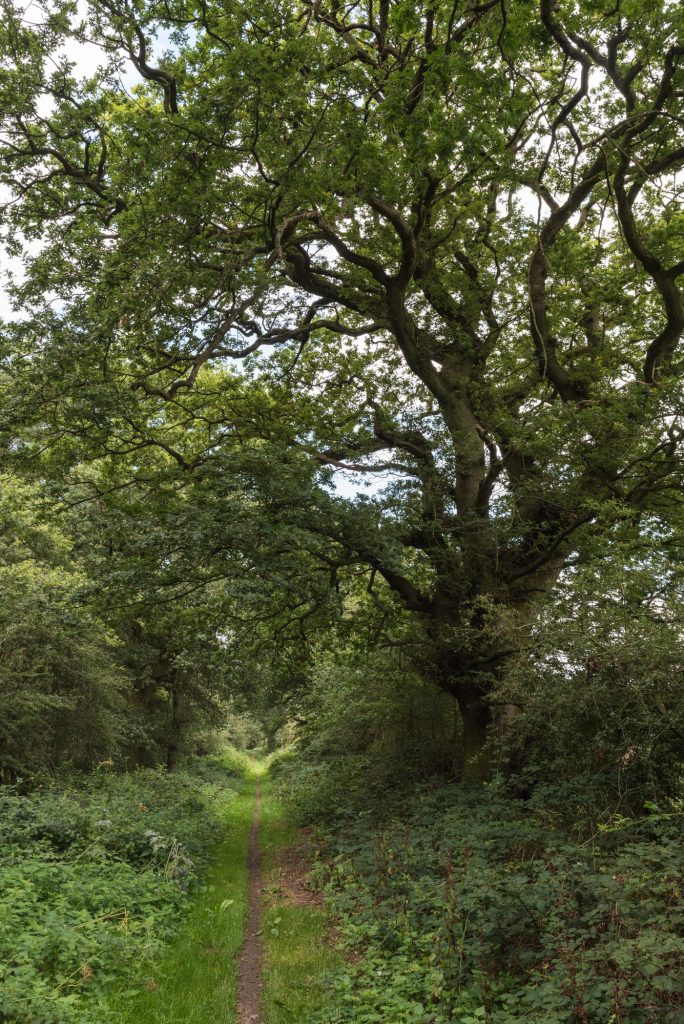
Isolated mature oaks are a striking feature of open, anthropogenic landscapes.
The Peddars Way regularly alternates between off- and on-road sections.
This section of the trail near Swaffham follows the disused railway line…
…which is less recognisable further on.
Old barn wall in South Acre.
The Norman priory and village church in Castle Acre from the South Acre Road.
River Nar at Castle Acre.
Priory ruins.
St. James’ church, Castle Acre.
This ultra-straight section of the Peddars Way perfectly follows the line of the ancient trackway.
A potential diversion, the junction with the bridleway to Houghton Hall.
Choose your rut.
To the west of the Peddars Way are numerous possibilities for entertaining diversions. Two of my favourites, both wildlife related, are Dersingham Bog SSSI and Snettisham RSPB reserve. The bog is a Nature Conservation Review site, Grade 2, a National Nature Reserve, a Ramsar site, a Special Area of Conservation and part of it is a Geological Conservation Review site.
Insectivorous honeydew plants at Dersingham Bog.
Mating azure damselflies.
The RSPB reserve is located at the edge of mudflats, lagoons and saltmarshes that compose The Wash. From later summer onwards, tens of thousands of wading birds are pushed inland by the highest tides, creating a natural spectacle.
Knot, dunlin, oystercatcher and black-tailed godwits flee the incoming tide that covers their feeding areas and roost around pools on Snettisham RSPB reserve.
The end of the straight section, southeast of Sedgeford.
Natural verges maintained for wildlife.
Summer plant and insect life.
Climbing gently over Ringstead Downs.
Ringstead Common.
A quick brew near Ringstead.
At Ringstead, F2C follows National Cycle Route 1 west on lanes running parallel to the main coast road. Several even smaller lanes join at the perpendicular, offering access to Thornham and Titchwell.
Dawn over late summer fields.
Rollercoaster lanes of North Norfolk.
The beach at Burnham Overy Staithe, another potential diversion north.
Track to ‘The Triumphal Arch’ opposite the North Gate to the Holkham Estate.
All Saints church, Wighton.
Binham priory.
The River Glaven at Wiveton.
Wiveton bridge.
St. Margaret’s church, Cley.
Cley Windmill.
Cley village from the west.
Norfolk Coast Path west of Cley.
Diverting east from Cley, either along the (often busy) coast road or the Coast Path, brings you to Salthouse. Like Cley, it is protected, for now at least, from the advancing North Sea by a shingle beach and expansive saltmarshes.
We use Google Analytics to analyze our website traffic, and to understand where our visitors are coming from. By browsing our website, you consent to our use of cookies and other tracking technologies. We'll assume you're OK with this, but you can opt-out if you wish. Read MoreACCEPT
Privacy & Cookies Policy
Privacy Overview
This website uses cookies to improve your experience while you navigate through the website. Out of these cookies, the cookies that are categorized as necessary are stored on your browser as they are essential for the working of basic functionalities of the website. We also use third-party cookies that help us analyze and understand how you use this website. These cookies will be stored in your browser only with your consent. You also have the option to opt-out of these cookies. But opting out of some of these cookies may have an effect on your browsing experience.
Necessary cookies are absolutely essential for the website to function properly. This category only includes cookies that ensures basic functionalities and security features of the website. These cookies do not store any personal information.
Any cookies that may not be particularly necessary for the website to function and is used specifically to collect user personal data via analytics, ads, other embedded contents are termed as non-necessary cookies. It is mandatory to procure user consent prior to running these cookies on your website.